
What drone imagery actually does for a real estate listing
Most agents already know drone photos exist. Fewer have thought through what they actually accomplish for a listing -- and what they don't.
Aerial imagery isn't just a visual upgrade. It adds a layer of context that ground-level photography simply cannot provide. Here's what it does when it's used well.
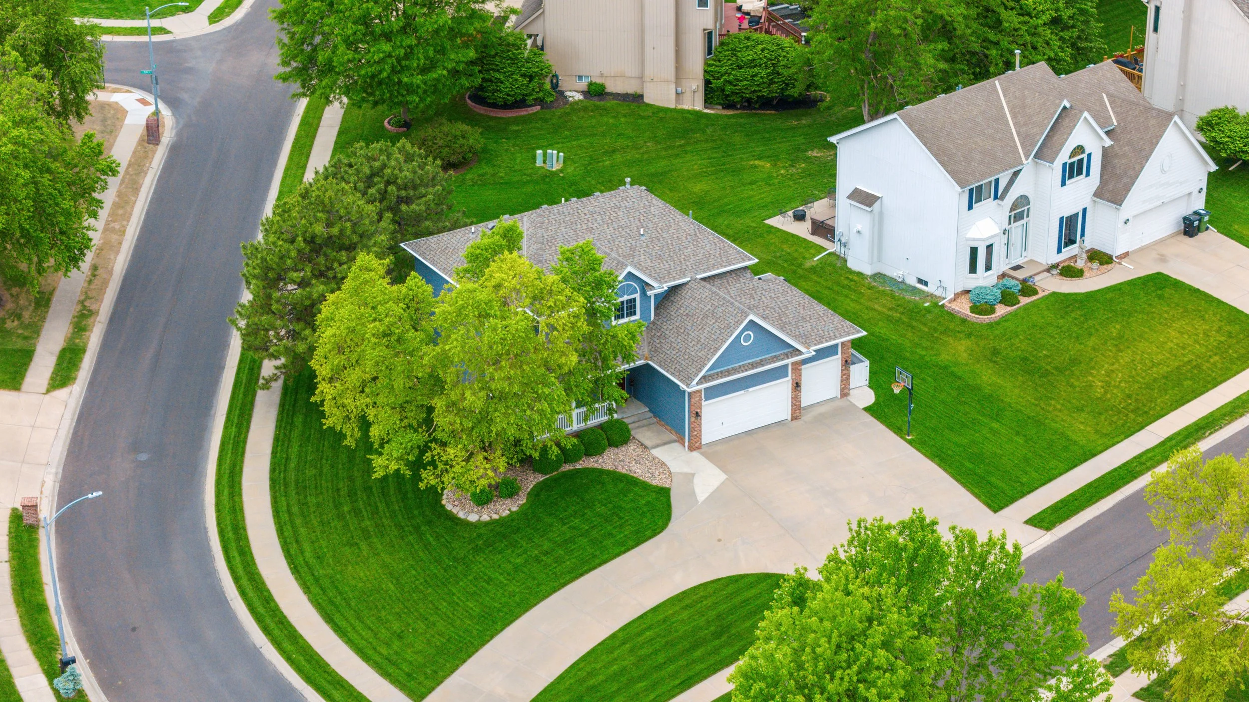
It shows the lot, not just the house
Interior and exterior photography captures the structure. Drone captures the land.
For buyers, lot size on a spec sheet is an abstraction. Seeing it from above makes it real. A half-acre lot reads very differently in aerial than it does as "0.52 ac" in the MLS. Corner lots, pie-shaped lots, rear-facing lots with alley access -- these are all features that aerial makes immediately legible.
This matters most for properties where the land itself is part of the value: large suburban lots, new construction on oversized parcels, rural acreage, or any listing where outdoor space is a primary selling point.
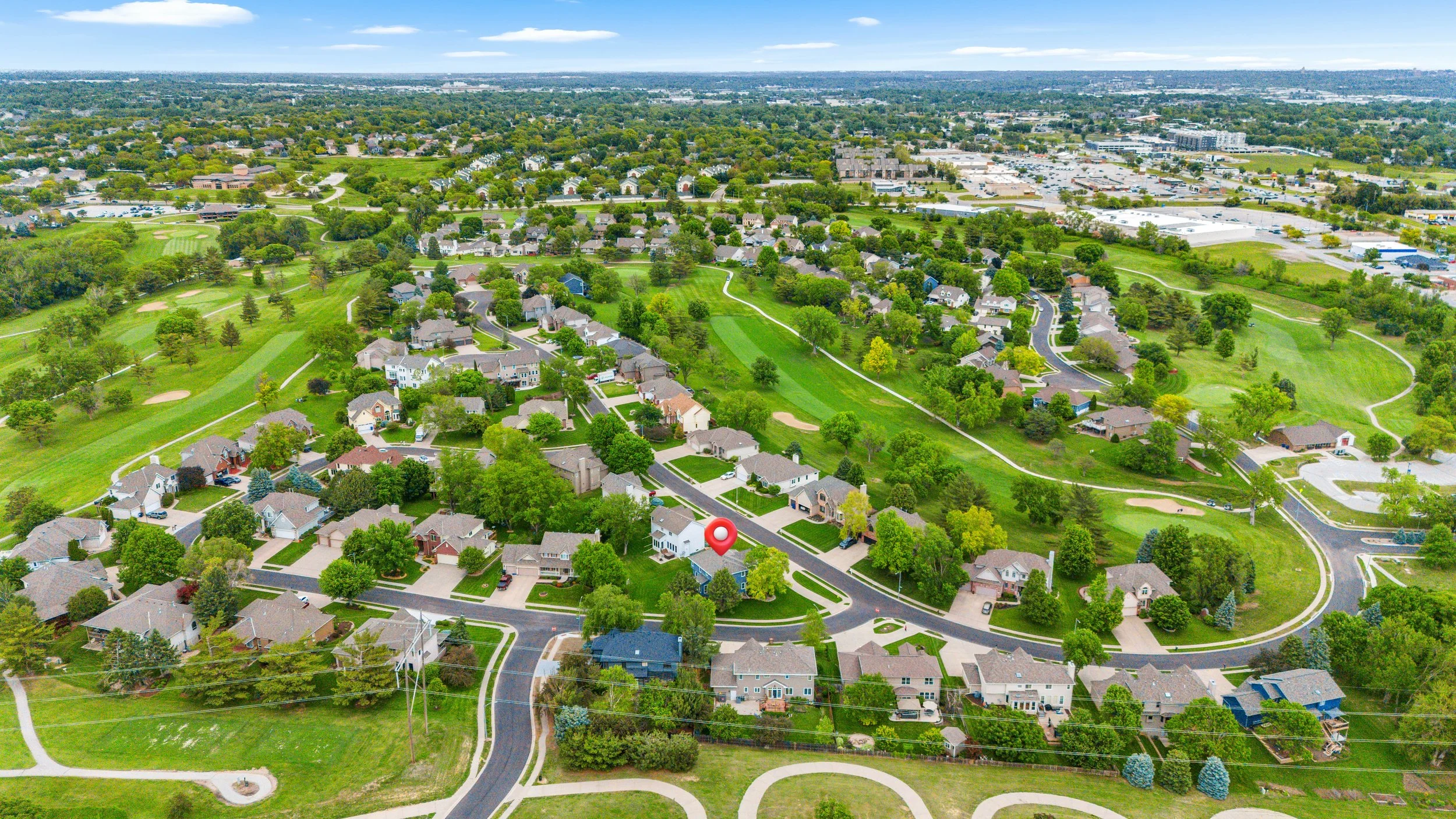
It answers the location question before buyers even ask
"How close is it to the highway?" "Is there green space nearby?" "What's the neighborhood actually like?"
Buyers ask these questions every time. Drone answers them visually before they have to.
An aerial shot that shows a listing two blocks from a forest preserve, or backing up to open farmland, or situated on a quiet cul-de-sac at the edge of a subdivision -- that context closes the gap between curiosity and confidence. Buyers who might have driven past the property on a weekend will book a showing instead.
For agents, this is particularly useful when representing a property in a location that has strong positional advantages that are hard to convey in ground-level images. The aerial makes the pitch for you.
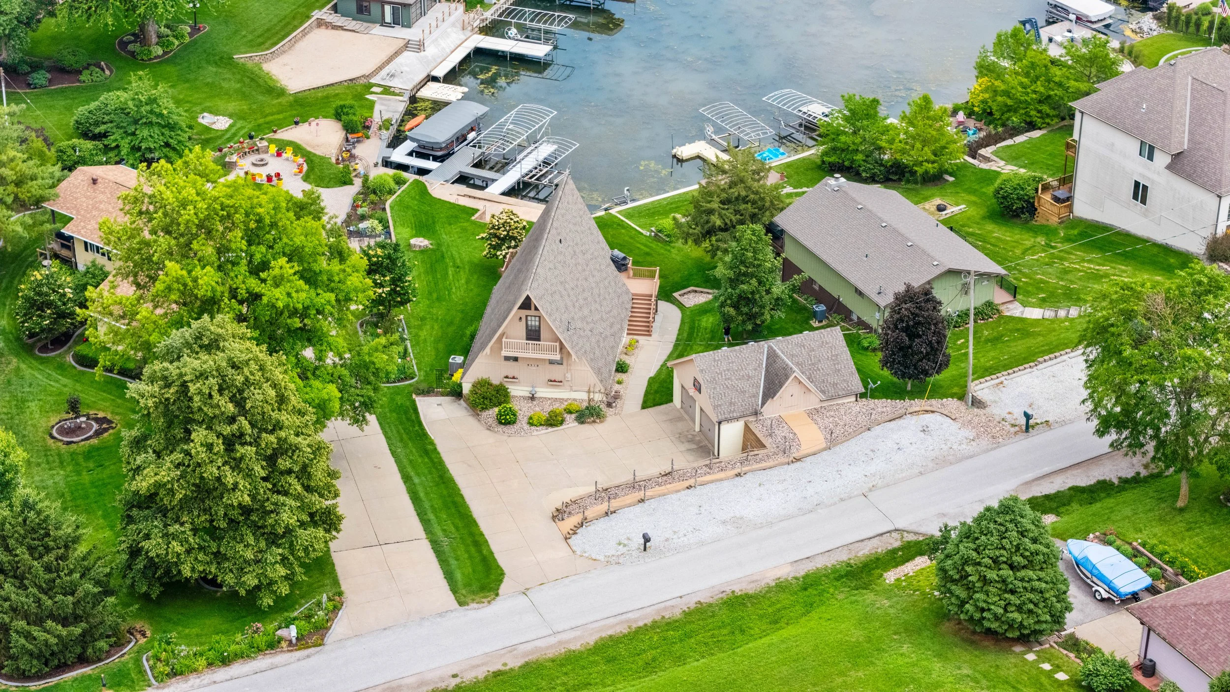
It gives buyers a structural overview they can't get otherwise
Buyers want to understand a property as a whole before they set foot inside it. Drone imagery provides that top-down orientation -- the roofline, the footprint, the relationship between the house and the garage, the driveway configuration, mature landscaping, and how the property sits on the lot.
This is especially relevant for larger homes, properties with detached structures, or any listing where the site layout is part of the appeal. It also reinforces quality: a well-maintained property with a clean roofline and healthy landscaping looks its best from above.
What drone doesn't replace
Aerial imagery works best as part of a complete media package, not a standalone feature. It provides context and overview, but interior photography, virtual tours, and floor plans are still what buyers rely on when evaluating the actual living spaces.
The combination is what moves listings. Aerial sets the stage. Interior media closes it.
For agents serving the Fox Valley and Northwest Chicagoland corridor -- where lot size and neighborhood character are often key differentiators -- drone imagery is one of the more direct ways to surface value that the MLS description alone won't carry.